IMD Issues Orange Warning for Thunderstorms
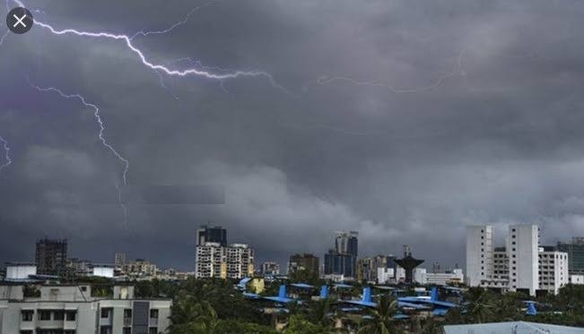
India Meteorological Department has forecast a week-long spell of unstable weather across Odisha, with thunderstorms, lightning, gusty winds and isolated hailstorms expected to affect several districts.
The department has issued Orange and Yellow warnings, urging residents to remain cautious as conditions may change rapidly during the pre-monsoon period.
Day 1: Widespread Rainfall and Thunderstorms Begin
Light to moderate rainfall accompanied by thunderstorms is expected across districts such as Puri, Khordha, Cuttack and Ganjam.
An Orange Warning has been issued for Mayurbhanj, Keonjhar, Balasore, Koraput and Malkangiri, where wind speeds may reach 50–60 kmph along with lightning.
A Yellow Warning is in place for coastal and central districts like Jagatsinghpur and Kendrapara, with comparatively lower wind speeds of 40–50 kmph.
Day 2: Intensification and Hailstorm Risk
Weather activity is likely to intensify, bringing rainfall to western, northern and coastal regions. Hailstorms are expected in districts including Mayurbhanj, Keonjhar, Balasore and Rayagada.
An Orange Warning continues for areas such as Bhadrak, Jajpur and Sundargarh, indicating the possibility of damaging winds and severe lightning.
Day 3: Continued Severe Weather Conditions
Thunderstorm activity will persist across most districts, with strong winds of up to 50–60 kmph and possible hailstorms in Sambalpur, Jharsuguda and parts of northern Odisha.
Yellow warnings remain for coastal and southern regions, where moderate thunderstorms and lightning are likely.
Day 4: Shift in Weather Pattern
Rainfall will continue across coastal and interior areas, while intense weather activity shifts towards northern and coastal districts like Balasore and Gajapati under Orange Warning.
Strong winds may continue to pose risks to infrastructure, agriculture and power supply systems.
Day 5 to Day 7: Gradual Reduction in Intensity
From the fifth day onwards, weather intensity is expected to decrease gradually. Yellow warnings will remain in place, with thunderstorms and winds of 30–40 kmph likely in coastal and southern districts.
Interior regions may receive isolated rainfall, while some areas could remain dry.
Key Concerns and Safety Advisory
- High risk of lightning, especially during afternoon and evening hours
- Gusty winds up to 60 kmph may damage trees, electric poles and temporary structures
- Hailstorms may affect crops, particularly in northern districts
Residents are advised to avoid open areas during thunderstorms, secure loose objects and follow official weather updates regularly.