IMD Predicts More Heavy Rain as Flood-Like Situation Grips Northern Odisha

Bhubaneswar: As northern Odisha grapples with flood-like conditions, the India Meteorological Department (IMD) on Monday forecast heavy to very heavy rainfall in several districts over the next 24 hours.
IMD Director General Mrutyunjay Mohapatra attributed the weather conditions to a low-pressure area over Gangetic West Bengal and adjoining north Odisha, which is expected to move west-northwestwards across Jharkhand in the coming hours. He added that the southwest monsoon remains active over the state and another round of intense rainfall is likely around July 5 and 6, due to an emerging cyclonic circulation over the same region.
An Orange Warning has been issued for Sundargarh, Sambalpur, and Jharsuguda districts, cautioning of heavy to very heavy rain accompanied by thunderstorms, lightning, and gusty winds reaching speeds of 30–40 kmph.
In the last 24 hours, Bamra in Sambalpur recorded the highest rainfall at 18 cm, followed by Balisankara in Sundargarh with 11 cm, and Kotpad in Koraput with 10 cm. Isolated areas in Sambalpur, Sundargarh, Koraput, Malkangiri, Kalahandi, Mayurbhanj, Keonjhar, and Nabarangpur also reported heavy downpours.
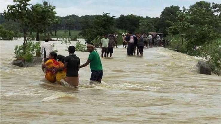
The relentless rainfall has led to flooding in several parts of Balasore and Mayurbhanj districts, submerging farmlands and cutting off multiple villages. Thousands of residents have been affected, prompting local authorities to stay on high alert as the situation develops.