IMD Issues Pre-Cyclone Watch for South Odisha Coast

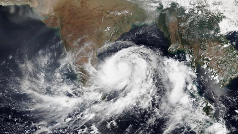
Bhubaneswar: The India Meteorological Department (IMD) has issued a pre-cyclone watch for the coasts of South Odisha as a weather system over the southeast Bay of Bengal is expected to intensify into a severe cyclonic storm in the coming days.
According to the Meteorological Centre in Bhubaneswar, the depression currently lies about 1,040 km south-southeast of Gopalpur. The system is likely to move west-northwestwards, strengthening into a deep depression by October 26 and further intensifying into a cyclonic storm by the morning of October 27.

The IMD’s forecast indicates that the storm will reach severe cyclonic storm intensity by the morning of October 28. It is expected to cross the Andhra Pradesh coast between Machilipatnam and Kalingapatnam, around Kakinada, during the evening or night of October 28. At landfall, the system may pack wind speeds of 90–100 kmph, gusting up to 110 kmph.
Though the core of the storm is projected to make landfall in Andhra Pradesh, Odisha is likely to experience significant and widespread adverse weather, primarily in the form of heavy rainfall. The IMD has issued a color-coded warning system for the state to help residents prepare for the changing conditions.
During the initial phase (October 26–27), light to moderate rainfall is expected in some parts of the state. As the system strengthens, rainfall activity will increase from October 27–28, with an Orange Alert (Be Prepared) in districts such as Malkangiri, Koraput, Nawarangpur, Kalahandi, Rayagada, Gajapati, Ganjam, and Kandhamal, where heavy to very heavy rainfall (7–20 cm) is expected. A Yellow Alert (Be Aware) for heavy rain (7–11 cm) has also been issued for Nuapada, Bolangir, Khurda, Puri, and Cuttack.
The peak impact phase (October 28–29) will bring the most severe conditions. A Red Alert (Take Action) has been sounded for Malkangiri, Koraput, Rayagada, Gajapati, and Ganjam, where extremely heavy rainfall exceeding 20 cm is likely. An Orange Alert covers nearby districts, while a Yellow Alert extends across coastal and northern Odisha, including Balasore and Mayurbhanj.
From October 29–30, the Red Alert will continue for southern interior districts like Malkangiri, Koraput, Nawarangpur, Kalahandi, and Rayagada, raising concerns over flooding and landslides due to prolonged heavy rainfall.
Squally weather conditions are expected along and off the south Odisha coast from the evening of October 26, with wind speeds increasing to 60–70 kmph and gusting up to 80 kmph by October 28.
The IMD has strongly advised fishermen not to venture into the southwest Bay of Bengal or along and off the Odisha coast between October 26 and 29. Those already at sea have been urged to return to shore immediately.
Distant Cautionary Signal No. I (DC-1) has been hoisted at all ports of Odisha. Meanwhile, the state government is expected to take precautionary measures, and residents in the alert zones are urged to remain vigilant and follow official advisories as the situation develops.


