Cyclone Senyar: Cyclonic storm formed, landfall likely today
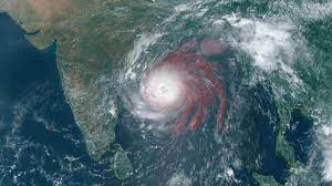
Bhubaneswar: The deep depression over the Strait of Malacca adjoining Northeast Indonesia in the Bay of Bengal intensified into Cyclone ‘Senyar’ on Wednesday morning, according to the Indian Meteorological Department (IMD).
The system had moved nearly westwards through Tuesday night into Wednesday morning with a speed of 10 kmph, and is likely to continue to move in a west-northwestwards direction. It is likely to cross the Indonesia coast before noon make landfall today.
The system will maintain the intensity of a cyclonic storm for the next 24 hours, and then gradually weaken.
As of 05:30 hours IST today, Cyclone Senyar lay centered near latitude 5.0°N and longitude 98.0°E, about 100 km east of Kuta Makmur (Indonesia), 260 km west-southwest of George Town (Malaysia), 600 km east-southeast of Nancowry (Nicobar Islands) and 740 km southeast of Car Nicobar (Nicobar Islands), according to IMD.
Another low pressure area has formed over southwest Bay of Bengal and adjoining areas of south Sri Lanka and equatorial Indian Ocean, which became a well-marked low-pressure area on Wednesday, as per IMD.
“The low-pressure area over southwest Bay of Bengal and adjoining areas of South Sri Lanka & Equatorial Indian Ocean lay as a well-marked low-pressure area over southwest Bay of Bengal and adjoining areas of Southeast Sri Lanka & Equatorial Indian Ocean at 0530 hours IST of today, the 26th November, 2025,” IMD said in its latest post on X.